IAH | Houston
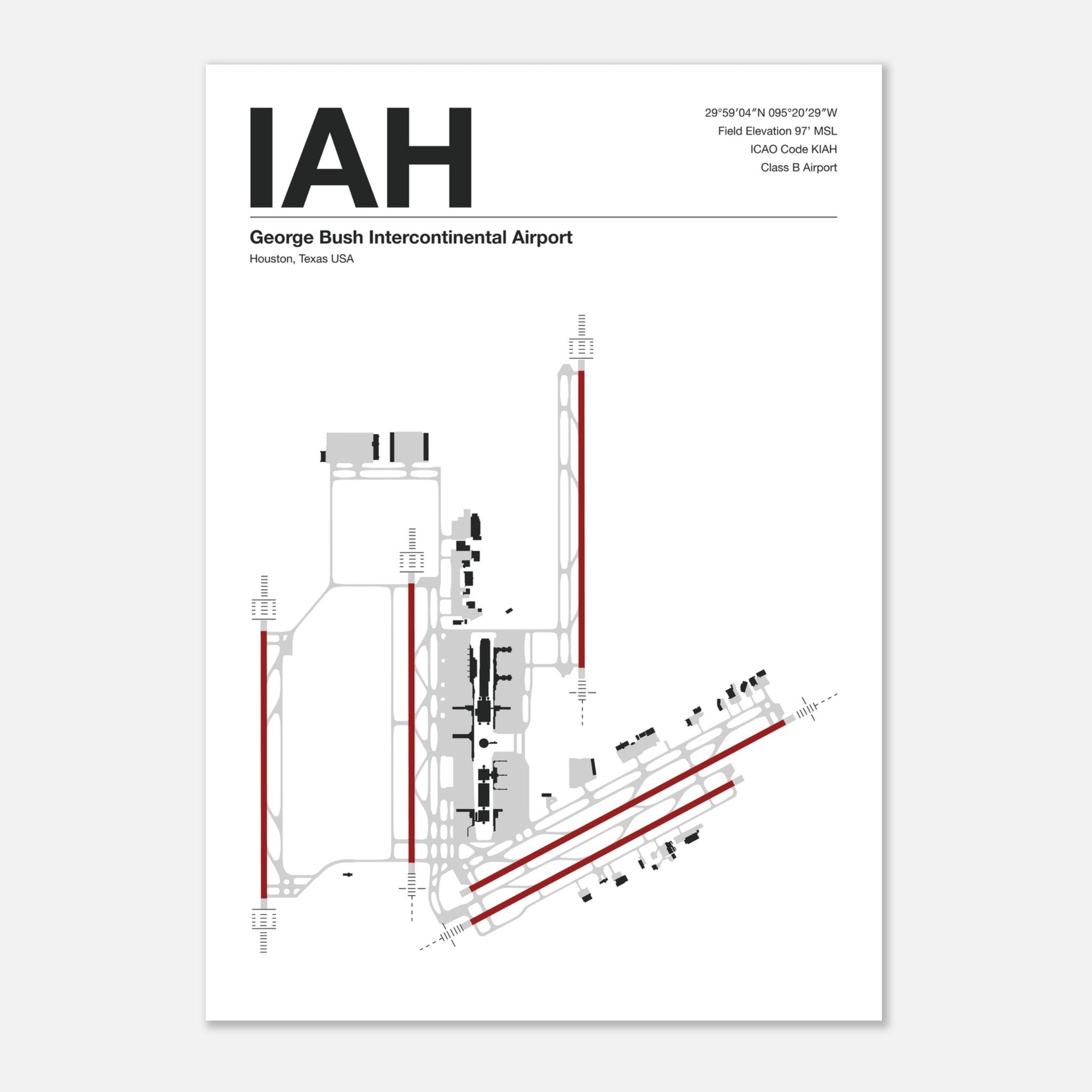
Bring a clean, timeless aviation aesthetic to your home, office, or hangar with our minimalist airport diagram posters. Designed for pilots, aviation enthusiasts, and design lovers alike, each poster features a layout showing runways, taxiways, airport buildings, and approach lighting—with text set in crisp Helvetica Neue typography for a modern, design-forward look.
Every print includes key airport details:
ICAO Code: The official four-letter code used by pilots and air traffic control worldwide (for example, EGLL for London Heathrow, KORD for Chicago O'hare).
Field Elevation: The airport’s height above sea level, essential information in aviation.
GPS Coordinates: The latitude and longitude of the airfield.
Airport Class (US airports): Whether it’s Class B, C, D, or E—this indicates the type of controlled airspace around the airport, reflecting its size and traffic. Class B airports handle the most traffic (think major international hubs), while Class D or E airports serve smaller, local airfields.
This blend of technical precision and minimalist design makes our prints perfect for living rooms, offices, pilot lounges, or flight schools. They’re more than just art—they’re a conversation starter and a subtle way to show your love for aviation.
Don’t see your airport listed? We can create a custom diagram for any airport in the world—just reach out and let us know.
Poster made on our lighter-weight, uncoated classic matte paper. The perfect option to stand the test of time:
- Paper Finishing: Matte, smooth, non-reflective surface.
- Paper Weight: 170 gsm (65 lb), thickness: 0.19 mm (7.5 mils), sturdy and durable.
- Sustainable Paper: FSC-certified or equivalent for sustainability.